
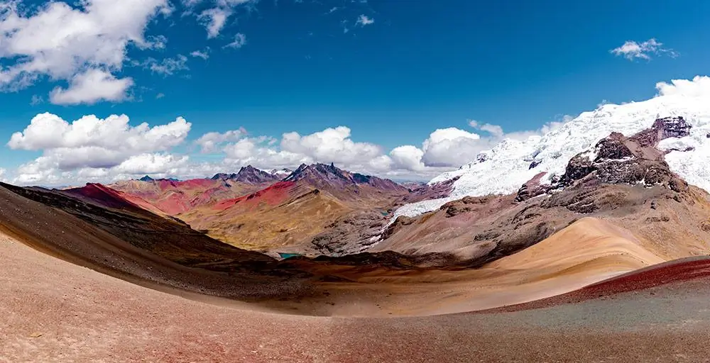
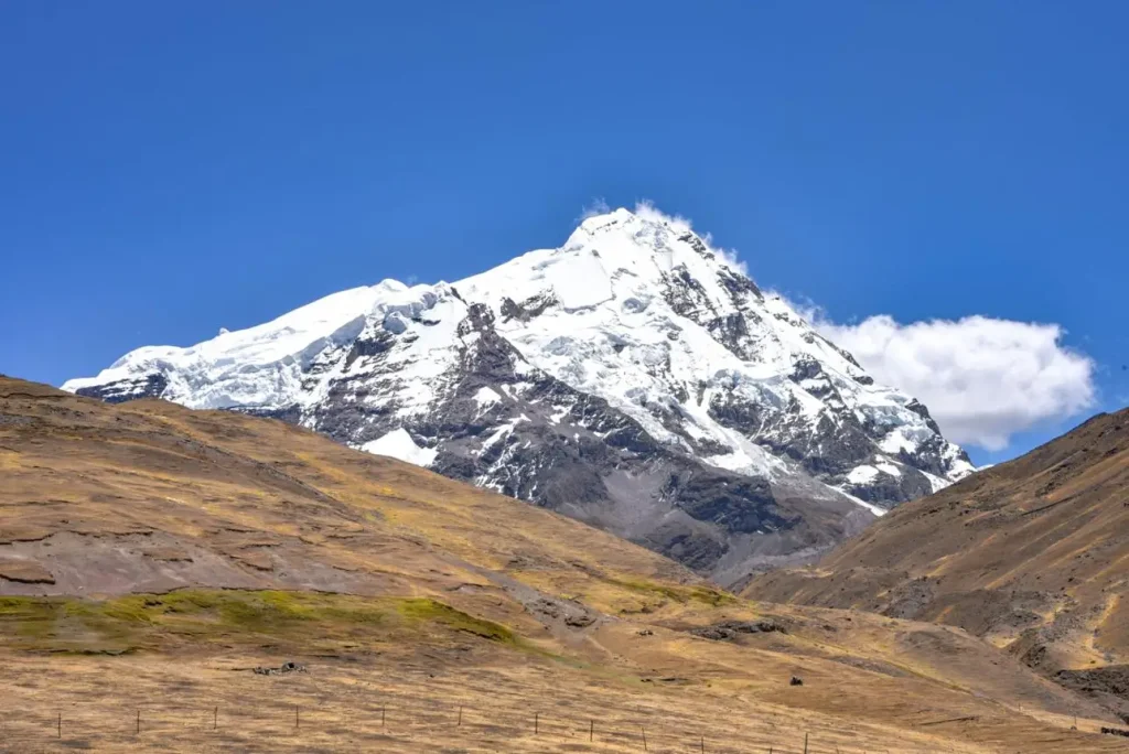
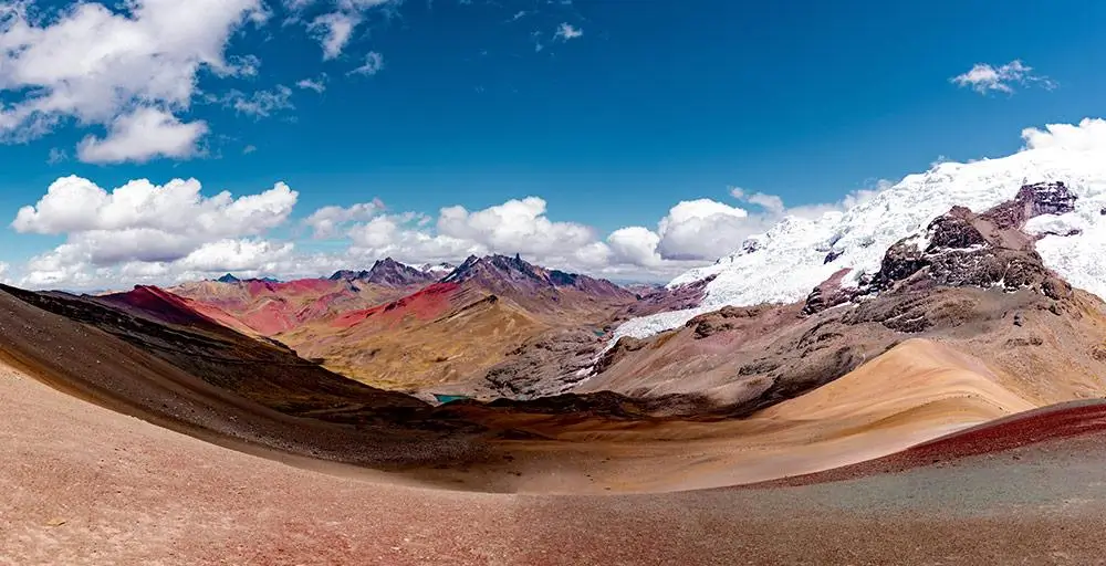
The snow-capped peak visible behind Vinicunca is Apu Ausangate, at 6,384 m the highest mountain in the Cusco region and the fifth-highest in Peru. It sits roughly 100 km southeast of Cusco in the Vilcanota mountain range — the same range Vinicunca belongs to — and dominates the skyline from the summit viewpoint on any clear day. Ausangate isn’t just a scenic backdrop: it’s one of the most revered Apus, or sacred mountain spirits, in Andean cosmology, and it’s the site of Qoyllur Rit’i, one of the largest indigenous pilgrimages in the Americas.
For the rest of the day’s logistics, see our complete Rainbow Mountain guide. This article is about what you’re actually looking at from that summit — and where the story goes if it interests you enough to want more.
The massif you see from the summit
Vinicunca sits inside the broader Ausangate massif, part of the Vilcanota mountain range southeast of Cusco. What you see from the viewpoint isn’t a distant, unrelated peak — Ausangate is the anchor mountain of the same conservation area Vinicunca sits within, which is why the two are almost always photographed together.
On a clear morning, the glaciated summit rises directly behind the colored ridge, giving the classic contrast that shows up in most Rainbow Mountain photography: warm mineral reds and golds in the foreground, cold white ice in the background.
Ausangate’s height and why it dominates the region
At 6,384 m (20,945 ft), Ausangate is the tallest peak in the entire Cusco region and the fifth-highest in Peru. That height is what makes it visible from so many vantage points across the southern Cusco highlands, not just from Vinicunca — its glaciated summit rises well above everything around it, including the 5,036 m ridge you’re standing on at Vinicunca’s viewpoint.
This isn’t a peak that gets climbed on a standard trekking itinerary. Ausangate’s summit sits well beyond the reach of hiking routes and requires technical mountaineering experience; the trekking circuits that carry its name circle the base of the massif rather than ascending it.
Apu Ausangate: the sacred mountain
In Andean cosmology, mountains aren’t scenery — they’re living beings, called Apus, believed to protect the communities and territory around them. Ausangate is one of the most powerful Apus in the region, historically linked to water, fertility, and agricultural cycles, since its glaciers feed the rivers that irrigate the valleys below.
Local families continue making offerings — despachos, prepared with coca leaves and other ritual elements — tied to journeys, harvests, and important community events, a living practice rather than a historical footnote. If this side of the trip interests you, Andean cosmovision explained covers the broader belief system Ausangate sits within.
Qoyllurit’i: the pilgrimage on its slopes
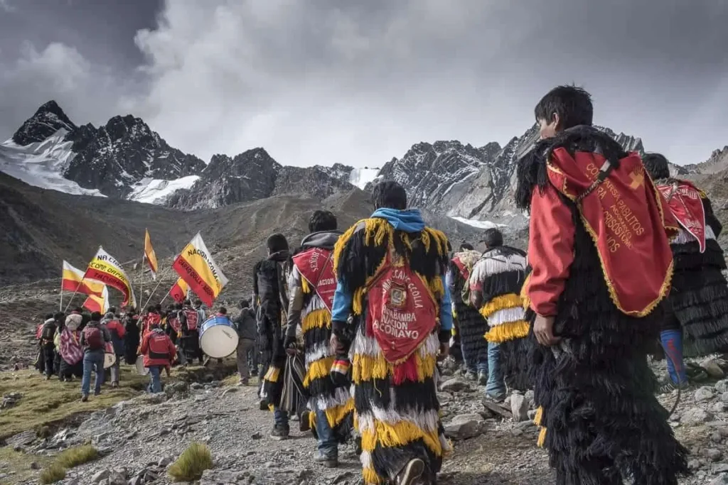
Every year, on the slopes of Ausangate near the town of Mahuayani, thousands of pilgrims gather for Qoyllur Rit’i — “Star Snow” in Quechua — one of the most significant religious and cultural events in the Andes. The pilgrimage blends Catholic tradition with the veneration of Apu Ausangate, taking place at an altitude of around 4,700 m, timed to fall a few days before the Western Corpus Christi, generally in late May or June depending on the year.
UNESCO recognized the pilgrimage as Intangible Cultural Heritage of Humanity in 2011, formal acknowledgment of a tradition that predates the Spanish conquest and has continued to adapt and grow since. Standing at Vinicunca and looking toward Ausangate, you’re looking at the exact mountain where that gathering happens each year.
Visibility: when you will actually see it clearly
Ausangate’s visibility from Vinicunca depends entirely on the weather, the same variable that determines how vivid the rainbow stripes themselves look on a given day. Dry season months — roughly May through September — give you the best odds of a clear, unobstructed view of the glacier, with June and July often producing the sharpest mountain visibility, though also the coldest early-morning temperatures at the trailhead.
Outside the dry season, cloud cover builds faster through the morning and can obscure Ausangate’s summit even when Vinicunca’s own colors remain visible. Early departures matter here for the same reason they matter for the color itself — arriving before mid-morning cloud buildup is your best chance at a clear shot of both.
Going further: the Ausangate trek
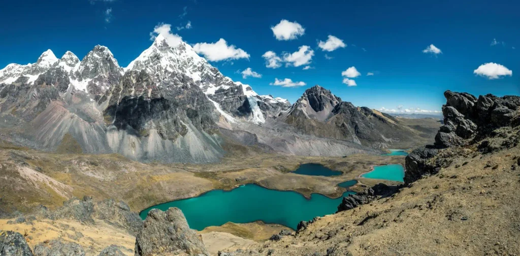
If seeing Ausangate from a distance leaves you wanting to actually walk its base, multi-day trekking circuits around the massif exist, ranging from shorter formats that include Vinicunca as a stop to longer circuits crossing passes above 5,000 m through glacial valleys, turquoise lagoons, and remote Quechua communities.
We run the 8-day Ausangate and Qoyllurit’i trek for travelers who want to go beyond the single day at Rainbow Mountain and spend real time in this landscape — including, depending on timing, proximity to the pilgrimage itself. For a longer, more ceremonial route through the wider sacred geography of the region, our 14-Day Peru Mystic Tour connects this area to other sites significant in Andean spiritual tradition, including ceremonies led by local paqos.
If a single day at the summit is what you’re planning for now, Rainbow Mountain: what to expect on the day walks through the full itinerary, and the Vinicunca trail step by step covers the hike itself in detail.
Why the geology here creates the colours
Vinicunca’s stripes and Ausangate’s glacier are part of the same geological story, even though they look nothing alike. The colored bands at Vinicunca formed roughly 24 million years ago as mineral-rich sediment — iron, chlorite, sulfur, and clay — was laid down in ancient lake and river basins, then tilted upward as the Andes rose through tectonic uplift. Iron oxide produces the reds and pinks, chlorite the greens, sulfur the yellows, and manganese compounds the purples and browns.
That entire striped cross-section stayed hidden under permanent snow and ice until relatively recently — the retreat of glacial cover in the 2010s, driven by regional warming, exposed the mineral layers that had been buried for millions of years. Ausangate’s much larger glacier, visible behind the ridge, is the same type of ice cover on a far bigger, higher massif — one that hasn’t retreated enough to reveal anything beneath it, and isn’t likely to in the way Vinicunca’s did.
If you’re weighing whether to see this from Vinicunca or the gentler alternative nearby, Vinicunca vs Palccoyo covers how the Ausangate views compare from each viewpoint.
| Peak | Approx. altitude | Direction from Vinicunca | Notes |
|---|---|---|---|
| Ausangate | 6,384 m (20,945 ft) | Southeast, dominant background peak | Highest in Cusco region; site of Qoyllur Rit’i |
Frequently Asked Questions
What mountain do you see behind Rainbow Mountain?
Apu Ausangate, at 6,384 m the highest peak in the Cusco region, visible directly behind the Vinicunca ridge on clear days.
Why is Ausangate considered sacred?
In Andean cosmology, Ausangate is one of the most powerful Apus — a living mountain spirit linked to water, fertility, and the protection of surrounding communities.
What is Qoyllur Rit’i?
An annual pilgrimage held on Ausangate’s slopes, blending Catholic and Andean spiritual traditions. It’s recognized by UNESCO as Intangible Cultural Heritage of Humanity.
Can you climb Ausangate from Vinicunca?
No. Ausangate’s summit requires technical mountaineering and is not part of standard trekking routes. Multi-day treks circle its base rather than ascend it.