9 Day Carabaya Trek
Overview
This truly off the beaten track adventure takes you into Carabaya, a remote and incredibly scenic
province with unmatched opportunities for true high-altitude exploration.
This hike is offered only by a few companies, and is possibly one of the most off the beaten track
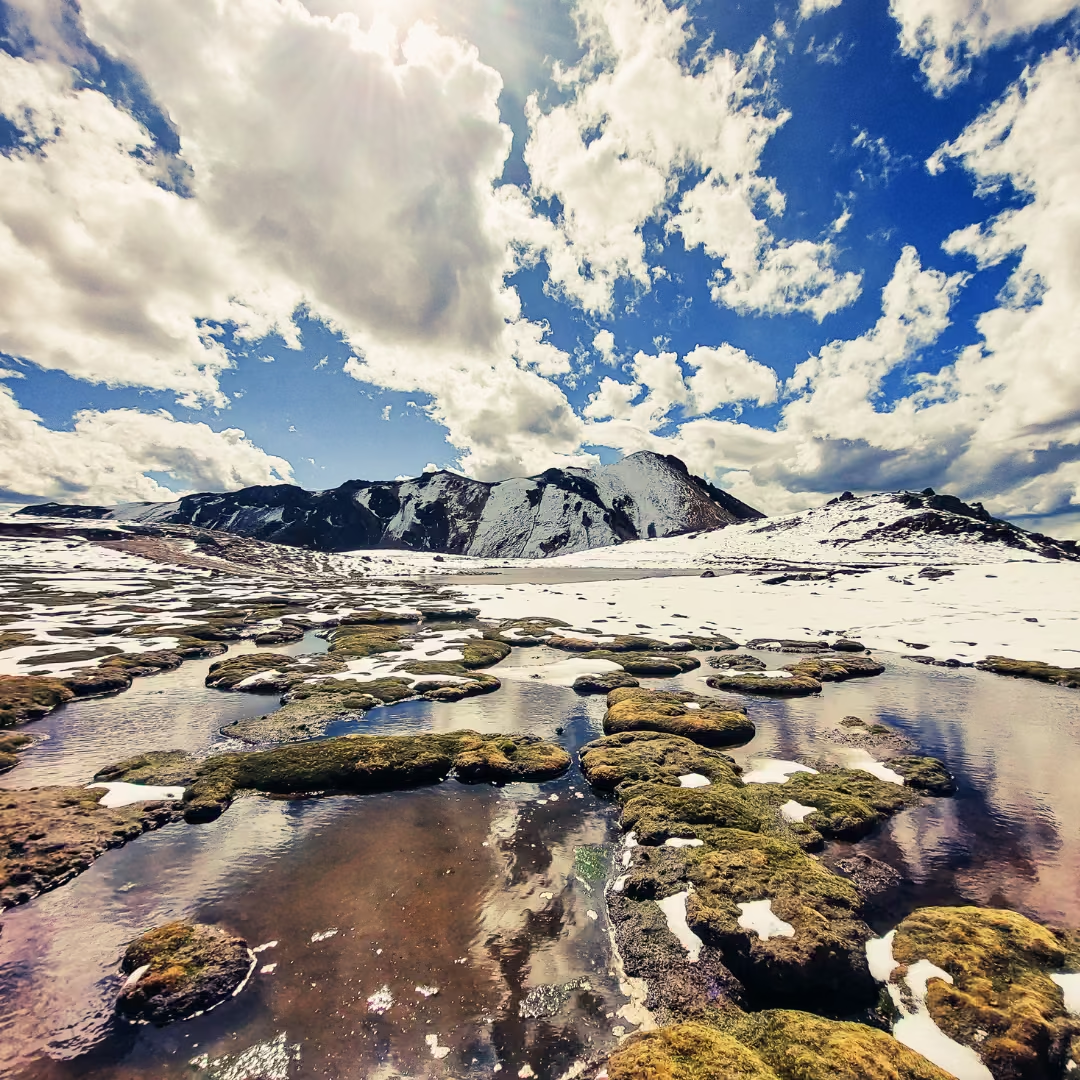
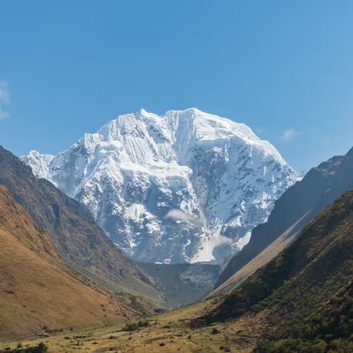
and challenging alternatives in the region. You are greeted by spectacular snow covered landscapes
that take your breath away – literally and figuratively! This is a high altitude trek and you should
be well acclimatized.
We can offer you this trek starting in Puno or in Cuzco.
The Ultimate Off-the-Beaten-Path Adventure: Trekking Carabaya’s Hidden High-Altitude Wilderness
Embark on one of Peru’s most remote and awe-inspiring journeys—a true expedition into Carabaya,
a rugged and seldom-visited province where towering snow-capped peaks, glacial lagoons, and
untouched Andean landscapes await. Far from the crowds of classic trekking routes, this is a raw,
high-altitude adventure reserved for those seeking uncharted beauty and a genuine test of endurance.
Why This Trek is Unlike Any Other
Extreme Rarity: Only a handful of specialized operators offer this route, making it one of the most
exclusive and least-traveled treks in the Peruvian Andes.
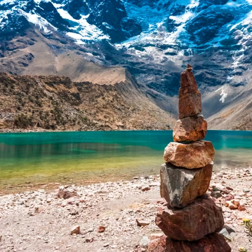
Unmatched Scenery: Traverse a dramatic world of glacial valleys, turquoise alpine lakes, and
6,000-meter (19,685 ft) giants, where condors soar and vicuñas roam freely.
High-Altitude Challenge: With sections reaching well above 5,000 meters (16,400 ft), this is
not just a hike—it’s a true mountaineering-style expedition requiring proper acclimatization
and stamina.
The Journey: A Test of Body and Spirit
Your adventure begins in either Puno (gateway to Lake Titicaca) or Cuzco (heart of the Inca Empire), from where you’ll venture deep into Carabaya’s untamed wilderness. Each step reveals:
Price per person
$ 2380.00 USD- Include Transport
- Pick up from your hotel
- Meals include
- Duration 8 Day
- Altitude 4,800 m
- Spanish, English , French
- Tickets Availability
- Inlude Hotel
- Relaxing
- Trip Style Hiking
- Groups size 02 and up
- Trip Starts in Puno
- Total distance 50 Km
- Include Kit
Located southeast of Puno, bordering Cusco and Madre de Dios, Carabaya is one of Peru’s most
remote and fascinating provinces. Known as “The Peruvian Switzerland” for its towering snow-capped
peaks, glacial lagoons, and otherworldly landscapes, this region is a paradise for explorers,
geologists, and lovers of authentic Andean culture.
For travelers seeking authenticity and extreme adventure, Carabaya offers:
High Altitude Trekking (5,000 + meters above sea level)
Carabaya-Apolobamba Trek: A 4 – to 9-day trek crossing from Peru, passing
through snow-capped mountains, isolated communities, and sacred lakes.
Ascents to Virgin Peaks: Many mountains here have never been climbed, a challenge for
expert mountaineers.
We leave Puno early for the four hour drive to our hike starting point. There’s plenty to see as we pass rock gardens, giant bromeliads and locals tending their crops and animals.
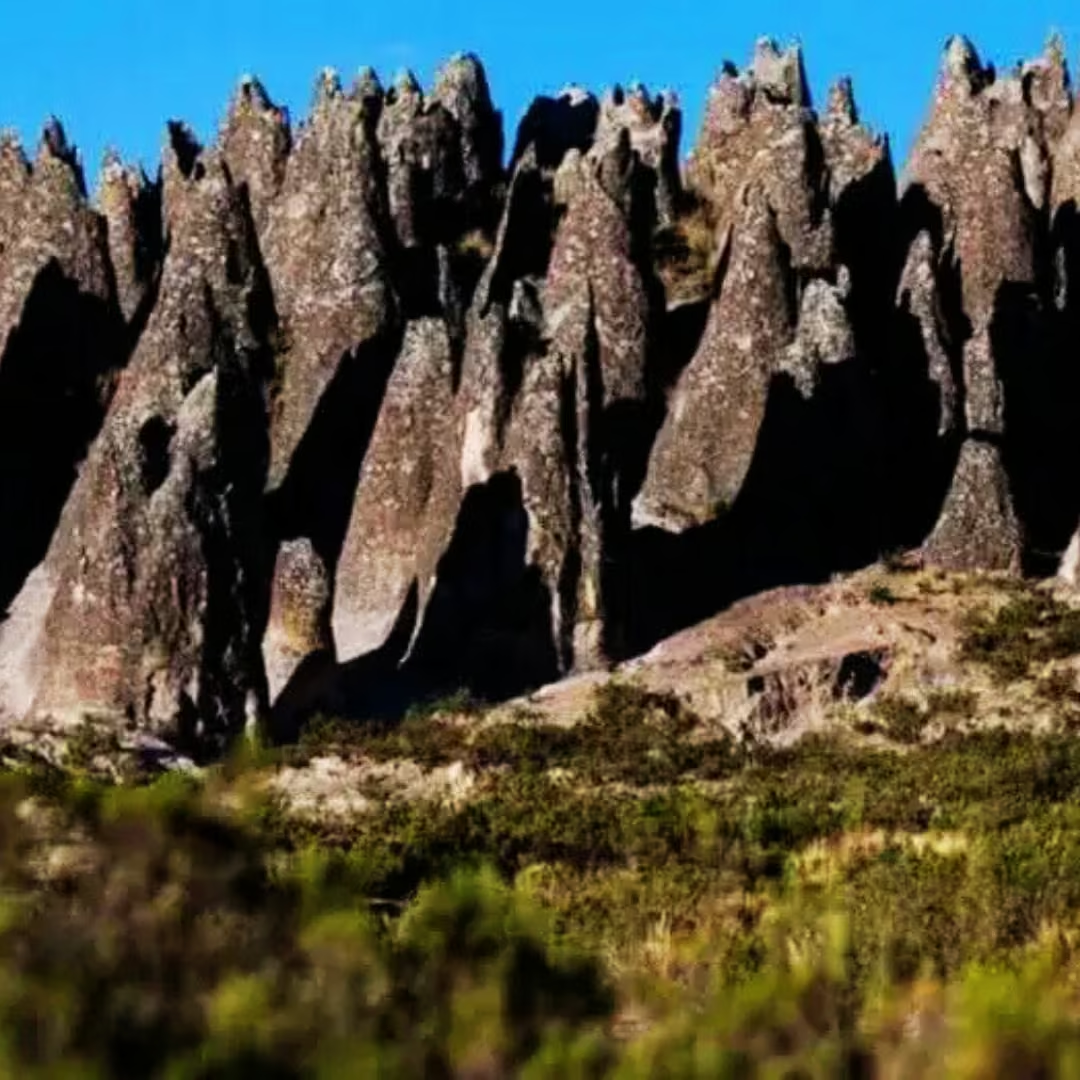
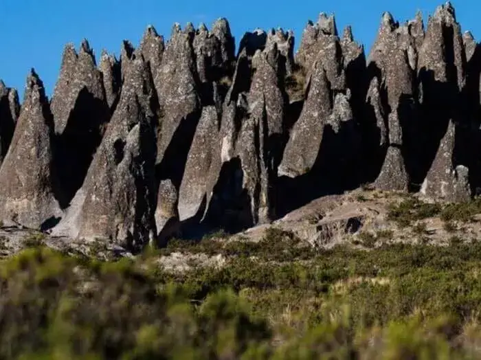
We’ll look down into the stupendous river canyon of the Rio Corani before turning off onto a back road with incredible views of the glacial valley that takes us to Aimaña. Here we’ll stop to check out the amazing rock formations before driving another 10 minutes to our first campsite, Veloyuc. Here, with luck, we’ll see vizcachas (native rabbit-like animals) and views of the snow capped Quelqaya peak.
- Walking time: 5-6 hours.
- Minimum altitude – 3,800m / 12,467ft.
- Maximum altitude – 5000m / 16,404ft.
- Altitude of camp – 4536m / 14,882ft.
- Approx. night temperature: Between -5 and 5 degrees Celsius (23-41°F).
After an early start we’ll head out east, spending five or six hours gently ascending 600 meters (1,970ft), through open valleys, past immense rivers and more bosques de piedra (rock forests) to the small valley where we have a scenic campsite near some hydroelectric infrastructures.
- Walking time: 5-6 hours.
- Minimum altitude – 4,536m / 14882ft.
- Maximum altitude – 4,700m / 15,420ft.
- Altitude of camp – 4,655m /15,272ft.
- Approx. night temperature: Between -5 and 5 degrees Celsius (23-41°F).
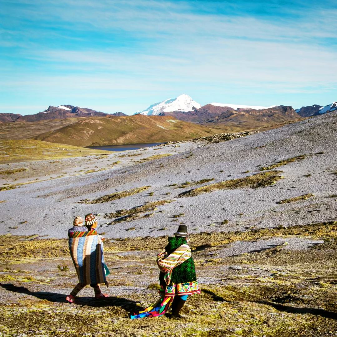
Today we climb to and camp at our first high pass, Chimboya (5,122m / 16,800ft). It takes about six hours to complete the ascent. In the pass we’ll enjoy well-deserved views of the Vilcanota range against the endless backdrop of the main Cordillera of the Andes, accompanied by curious llamas, alpacas and vicuñas.
- Walking time: 5-6 hours.
- Minimum altitude – 4,655m / 15,272ft.
- Maximum altitude – 5,122m / 16,800ft.
- Altitude of camp – 5,121m / 16,800ft.
- Approx. night temperature: Between -5 and 5 degrees Celsius (23-41°F).
We continue to enjoy spectacular views of the glacier-topped Vilcanota range as we make our way through a varied landscape of swamp and open pampas (flat grasslands) to Hacienda Mates, our campsite for the night, in a sheltered valley surrounded by steep slopes.
- Walking time: 5-6 hours.
- Minimum altitude – 4,773m / 15,660ft.
- Maximum altitude – 5,122m / 16,800ft.
- Altitude of camp – 4,773m / 15,660ft.
- Approx. night temperature: Between -5 and 5 degrees Celsius (23-41°F).
Today a rewarding seven hour walk first brings us up to an altitude of more than 5,000m (16,400ft). From here we’ll have equally breathtaking views of the Nudo del Vilcanota (knot of the Vilcanota) and our first glimpses of the mysterious lakes, Sibinacocha and Cascara. We’ll see pink flamingos and vicuñas as we cross the Pucamayu river and make our way to our campsite at Cascara. Here we can fish in the lake and observe migrating ducks and other wetlands birds.
- Walking time: 6-7 hours.
- Minimum altitude – 4,773m / 15,660ft.
- Maximum altitude – 5,000m / 16,400ft.
- Altitude of camp – 4,900m / 16,076ft.
- Approx. night temperature: Between -5 and 5 degrees Celsius (23-41°F).
Another big pass awaits us, Yayamari (5,100m / 16,730ft). From here we’ll experience the most stunning views yet with lakes, nearby towering rock outcrops, many massive peaks, and Sibinacocha Lake, to which we will descend to camp.
- Walking time: about 7 hours.
- Minimum altitude – 4,900m / 16,076ft.
- Maximum altitude – 5,100m / 16,732ft.
- Approx. night temperature: Between -5 and 5 degrees Celsius (23-41°F).
After a morning walking through the gentle pampas of Sibinacocha, we’ll ascend about an hour to the important Condor pass at a massive 5235m (17,175ft). From here we’ll see magnificent views which include the even higher, ice-covered Acero Pass (5,500m / 18,050ft), before descending for half an hour and walking another hour or so of ‘Andean flat’ to our campsite at Killita.
- Walking time: about 7 hours.
- Minimum altitude – 4,735m / 15,540ft.
- Maximum altitude – 5235m / 17,175ft.
- Altitude of camp – 4,735m / 15,540ft.
- Approx. night temperature: Between -5 and 5 degrees Celsius (23-41°F).
This morning we’ll walk around two hours to Paso Falso (False Pass) from where we’ll take in the magnificence of the towering Ausangate, the highest peak in the Cuzco department and its most important Apu (God). Then it’s an afternoon of ups and downs. First we’ll descend to the community of Ccampa, then climb back up to Ccampa Pass (5,080m / 16,666ft), then descend again to Ninapara where we’ll camp.
- Walking time: 6-7 hours.
- Minimum altitude – 4,656m / 15,275ft.
- Maximum altitude – 5,080m / 16,666ft.
- Altitude of camp – 4,656m / 15,275ft.
- Approx. night temperature: Between -5 and 5 degrees Celsius (23-41°F).
We start our last day with an up and a down on our final walk past the awesome Ausangate, and three hours down to Pacchanta where we’ll enjoy lunch and a soak in the local natural hot springs! After lunch we’ll drive for about four hours back to Cuzco.
- Walking time: about 4 hours.
- Minimum altitude – 4,336m / 14,225ft.
- Maximum altitude – 4,656 m / 15,275ft.
- Pre-trek briefing.
- Collection from your hotel on the morning of trek departure.
- Transport from Puno (or Cuzco) to the trailhead at the beginning of the trek in private vehicle.
- English/Quechua/Spanish speaking professional guide (you will have an assistant guide for groups over 6 people).
- Tents – 2 people in a 4 person tent which allows for greater comfort, and also storage of backpacks.
- Basic foam mattress. If you require greater comfort during the trek we can rent you an inflatable mattress (e.g. Thermarest).
- Cook and Cooking equipment (Assistants are provided for larger groups)
- Toilet tent.
- Meals as indicated in the itinerary (optional vegetarian food). Our professional cooks prepare meals that incorporate elements of the western diet and also traditional diet.
- Peruvian delicacies. (Please communicate with your guide/cook during the trek if you have a preference for certain types of dishes). Salads, if served, are washed in boiled water.
- Horses (for equipment and personal items) including horsemen. They carry camping equipment, food and kitchen utensils. We provide duffel bags at your briefing for your personal items (up to 7 kg/15 lbs. per person).
- 1 emergency horse which can be ridden if you are feeling ill or if you are a little slower. Let us know if you would like to hire a personal riding horse.
- Dining tent with camp tables and chairs and kitchen tent for the cook to prepare meals.
- Tents for our staff.
- First aid kit including emergency oxygen bottle.
- Sleeping bags. If you haven’t got a sleeping bag or you don’t want the hassle of bringing one all the way to Peru with you, then we have sleeping bags for hire.
- If you want to take more substantial items or backpacks, you will need to hire an additional mule. Also you an hire a personal riding horse.
- Gratuities for the staff.
- Clothing
- Lightweight and moisture-wicking clothing for hiking
- Long-sleeve shirts and pants for sun and insect protection
- Warm layers for the cool evenings (fleece or down jacket)
- Waterproof jacket and pants (for rainy weather)
- Hat or cap for sun protection
- Warm hat, gloves, and scarf for cold nights at higher altitudes
- Comfortable hiking boots (broken-in and waterproof)
- Comfortable camp shoes (sandals or lightweight shoes)
- Wool or synthetic socks (bring several pairs)
- Essential Gear
- Daypack (25-30L) for carrying your personal items
- Large duffel bag for porters to carry (preferably waterproof)
- Sleeping bag (fiber-filled, as provided)
- Sleeping pad (if not provided, confirm with the tour organizer)
- Headlamp or flashlight with extra batteries
- Waterproof bags to protect electronics and clothing
- Reusable water bottle (at least 2L capacity)
- Personal hygiene items (toothbrush, toothpaste, etc.)
- Sunscreen (high SPF) and lip balm with sun protection
- Insect repellent (DEET-based recommended)
- Personal Items
- Passport and copies (for entry into Machu Picchu)
- Travel insurance documents
- Credit card or cash (for personal expenses)
- Camera or phone (with extra memory cards and batteries)
- Personal medication and a small first-aid kit (band-aids, antiseptic, etc.)
- Optional Items
- Snacks (energy bars, trail mix)
- Lightweight trekking poles (optional but recommended for the Inca Trail)
- Binoculars for bird watching
- Notebook or journal
- Small lock for your duffel bag
- Make sure all your gear is lightweight and waterproof, as weather can change quickly.
- Ensure you have proper hiking boots that are well-broken-in before the trek to avoid blisters.
- Pack light, as porters will carry your equipment, but there are weight restrictions for what can be carried.
Location the 9 Day Carabaya Trek
1. Where is Carabaya located?
Carabaya is a remote province in the department of Puno (Peru), near the border with Cusco and Madre de Dios. Its capital is Macusani, known as the “Land of the Alpaca.”2. Is prior high-altitude trekking experience necessary?
✅ Yes, it is recommended. This is a demanding trek, with altitudes exceeding 5,000 meters above sea level, technical terrain, and unpredictable weather.Recommended for:
People in good physical condition.
Travelers with prior experience at altitude (e.g., Salkantay, Ausangate, Huayhuash).
Those who have acclimatized for at least 2-3 days in Cusco or Puno.
3. What is the best time to do this trek?
time to do this trek? ⏳ Dry season (May to September):Clear days, cool nights (down to -10°C).
Ideal for photography and avoiding rain.
⚠ Avoid the rainy season (November to March):
Muddy trails, risk of snowfall, and reduced visibility.
4. Are there options for beginners or shorter routes?
🔹 Yes, but limited. Some less extreme alternatives include:Trekking to Laguna Rinconada (1 day from Macusani).
Exploring Tinajani Canyon (moderate hike, 3-4 hours).
Visit to hot springs in Putina Punco (ideal for post-trek relaxation).

